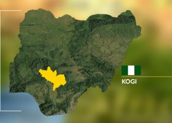

The long-running effort to demarcate the boundary between Edo and Kogi states is facing fresh delays, with missing historical landmarks, competing claims and resistance from communities along the disputed areas complicating the process.
Director-General of the National Boundary Commission (NBC), Adamu Adaji, disclosed the challenges in an interview, explaining that some of the geographical features originally used to define the boundary have disappeared over time.
Adaji said the commission is working to reconstruct the boundary using historical records and other available evidence while also considering claims and documents presented by the two states.
1954 Legal Notice at Centre of Boundary Dispute
According to Adaji, the Edo-Kogi boundary was originally defined by Legal Notice No. 126 of 1954, which established the boundary between the former Northern and Western Regions.
However, some of the geographical features referenced in the legal document no longer exist, creating difficulties for experts trying to translate the historical description into a precise boundary line on the ground.
The disappearance of those landmarks means that the commission cannot simply rely on the original physical reference points to establish where the boundary should be marked today.
The NBC has therefore had to examine historical records and the positions advanced by both states as part of the demarcation process.
Communities Reject Proposed Boundary Line
Adaji said the commission had considered the positions of Edo and Kogi and arrived at a line it regarded as representing the boundary between the two states.
The proposed line was subsequently approved by the Internal Boundaries Committee, paving the way for physical demarcation.
However, communities located along the proposed boundary objected to the planned marking, arguing that the line did not correspond with their understanding of where the boundary lies.
The disagreement has consequently prevented the commission from completing the physical demarcation exercise.
The situation reflects the wider complexity of interstate boundary disputes in Nigeria, where administrative boundaries can intersect with longstanding community identities, traditional claims and land ownership interests.
New Documents Could Change Boundary Assessment
The NBC director-general also disclosed that some parties had submitted additional documents which could have implications for the determination of the boundary.
Among the materials were court decisions which, according to Adaji, had not previously been made available to the commission.
The commission is expected to examine the documents alongside the state governments before determining how they affect the ongoing process.
Adaji said the parties had agreed to proceed with demarcation once the necessary resources were secured.
Areas Affected by Edo-Kogi Boundary Disputes
The boundary disagreements reportedly affect several areas, including Ogori-Ekpedo, Okene-Okpella and Ake.
There are also land-related disputes involving Ibaji communities in Kogi State and Uloshi and Esan South-East communities in Edo State.
These areas have remained part of the broader challenge confronting authorities seeking to establish an agreed administrative boundary between the two states.
The difficulty is compounded where communities have their own understanding of traditional or historical territorial limits that may differ from the administrative line being reconstructed by government authorities.
Kogi’s geographical position makes its boundaries particularly significant because the state shares borders with several other states and serves as an important connection between different parts of Nigeria. Recent security developments have also highlighted the importance of interstate coordination, including along the Kogi-Edo corridor. Kogi Moves to Block Terrorists, Criminals From Entering State.
Why the Dispute Matters Beyond Maps
Boundary demarcation is not simply about drawing a line on a map. Clearly established administrative boundaries help determine which state government and local authorities are responsible for particular communities and areas.
Unresolved boundaries can create uncertainty over administration, development responsibilities and the implementation of government programmes.
They can also become sensitive where communities have competing claims over land or natural resources.
Recent developments along the Kogi-Edo border have demonstrated how closely communities in the two states can be connected. Security operations, for example, have involved cooperation across the state boundary when responding to criminal activity and kidnapping threats. Kogi NYSC Abduction: 11 Rescued as Search Continues for Remaining Corps Members.
NBC Appeals for Community Cooperation
Adaji called on communities and local authorities to cooperate with the boundary commission as the process continues.
He stressed that state boundaries are primarily intended to serve an administrative purpose and should not be interpreted as preventing individuals from owning property on either side of a state boundary.
The appeal is aimed at reducing tensions among communities that may fear losing access to land or having longstanding relationships disrupted by the formal demarcation process.
The commission’s position is that a properly established administrative boundary can coexist with the rights of individuals and communities to own property across state lines, subject to applicable laws.
Abia-Anambra Boundary Makes Progress
While the Edo-Kogi process remains unresolved, the NBC says there has been progress in another interstate boundary dispute involving Abia and Anambra.
Adaji said the two states share an approximately 23-kilometre boundary, of which about 15 kilometres have been agreed upon, leaving roughly eight kilometres still unresolved.
The two states agreed in July to support fieldwork aimed at determining the disputed section.
According to the NBC’s approach, two lines reflecting the respective positions of the parties may initially be marked before further discussions produce agreement on a single boundary.
The development demonstrates the commission’s use of technical fieldwork and negotiation in attempting to resolve disagreements where states have different interpretations of their common boundaries.
Edo-Kogi Demarcation Awaits Next Phase
For Edo and Kogi, however, the disappearance of historical landmarks, competing documentary evidence and objections from communities remain major obstacles to completing the demarcation.
The NBC is expected to review the additional documents submitted by the parties and work with the two state governments before the physical exercise proceeds.
The commission’s efforts come as security concerns continue to affect communities and transport routes around Kogi and neighbouring states. The Bureau Journal recently reported a fresh security alert after residents in parts of Kogi reported sighting armed men near Oke-Ere, although the identity and intentions of those men remained unconfirmed. Kogi Security Alert: More Than 50 Armed Men Reportedly Sighted Near Oke-Ere.
Another recent report documented an attack on an ADC meeting in Ejule, Ofu Local Government Area, underscoring the need for authorities and communities to manage local tensions carefully. Kogi Political Tension: Gunmen Storm ADC Meeting in Ejule, Several Injured.
Until the outstanding historical, legal and community issues are resolved, the final physical demarcation of the Edo-Kogi boundary is likely to remain a work in progress.
For the National Boundary Commission, the immediate task is to reconcile the historical legal description with present-day realities while ensuring that the affected states and communities are part of the process.
Get breaking news and latest updates directly on WhatsApp